To contribute to this site, see above menu item "About".
These transcriptions may contain human errors.
As always, confirm these, as you would any other source material.
| Newfoundland's Grand Banks Genealogy Site Ferryland District |
|
|
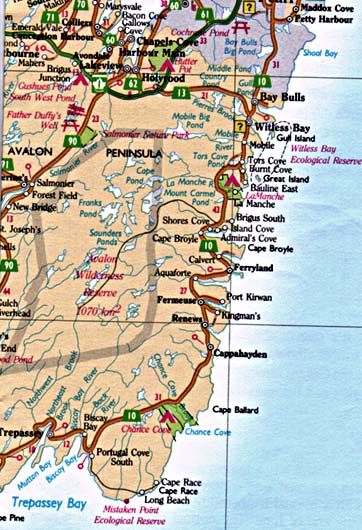
This is a good starting point for people researching their ancestors in Newfoundland's Ferryland District commonly referred to as "The Southern Shore". This district currently extends from it's northern boundary in The Gould's (beginning approximately south of Doyle's Road and Petty Harbour Road), and includes all settlements along Route 10 of the Irish Loop. Its southern boundary is located at the settlement of St. Shotts at the most southerly tip of the Avalon Peninsula, between Trepassey and St. Mary's Bays. However, be aware that district boundaries have changed over the the years, and Ferryland District, like most, may be shown with somewhat different boundaries in earlier documents. Help Wanted! Can you help us locate:
|
 |
Our Collection of Ferryland District Information
|
Ferryland District Coordinator:
|
Page Revised by Kevin Reddigan (November 09, 2016)
Newfoundland's Grand Banks is a non-profit endeavor.
No part of this project may be reproduced in any form
for any purpose other than personal use.
JavaScript DHTML Menu Powered by Milonic
© Newfoundland's Grand Banks (1999-2025)
Hosted by
![]()
Your Community, Online!
![[Recent]](../recent.gif)
![[Contacts]](../contacts.gif)
![[Home]](../home.gif)