
To contribute to this site, see above menu item "About".
These transcriptions may contain human errors.
As always, confirm these, as you would any other source material.
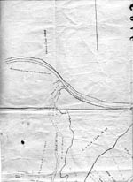
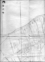
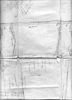
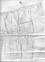
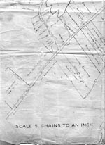
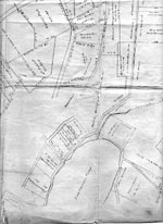
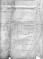
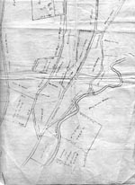
1950's Map of Lance Cove and Upper Gully
Survey map of the Lance Cove/Upper Gully area of the Harbour Main District. Please note that these map files are large and |
 |
 |
 |
 |
 |
 |
 |
 |
These map images are the sole property of Susan Lawrence
Reproduced here by her permission (November 2004)
Page Revised by Craig Peterman (Tuesday March 26, 2013)
Newfoundland's Grand Banks is a non-profit endeavor.
No part of this project may be reproduced in any form
for any purpose other than personal use.
JavaScript DHTML Menu Powered by Milonic
© Newfoundland's Grand Banks (1999-2025)
Hosted by
![]()
Your Community, Online!
![[Recent]](../recent.gif)
![[Contacts]](../contacts.gif)
![[Home]](../home.gif)