Share/Save/Bookmark

Presented by the
Newfoundland's Grand Banks Site
to assist you in researching your Family History

Click on the graphic below to return to the NGB Home Page
Newfoundland's Grand Banks

To contribute to this site, see above menu item "About".

How to report a possible transcription error

These transcriptions may contain human errors.
As always, confirm these, as you would any other source material.

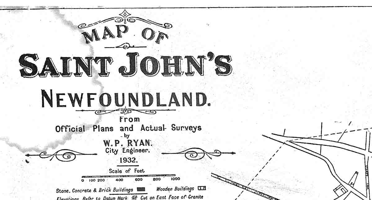
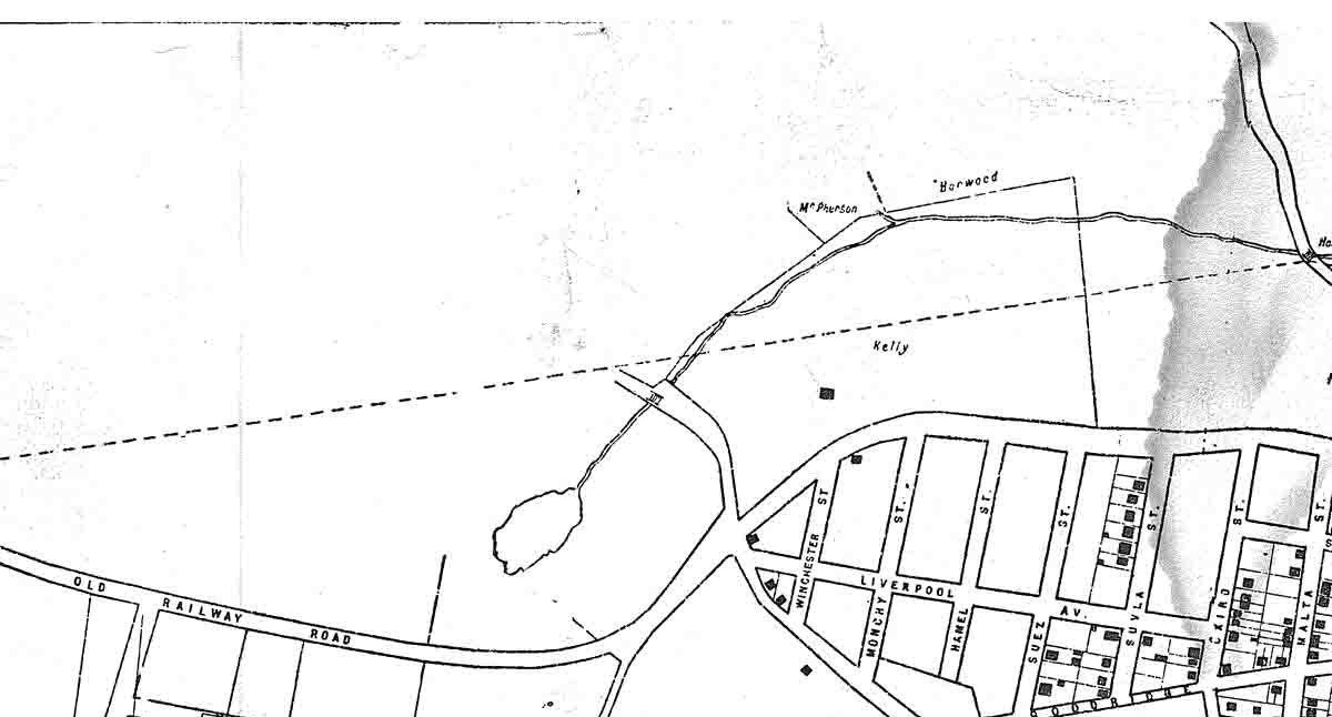
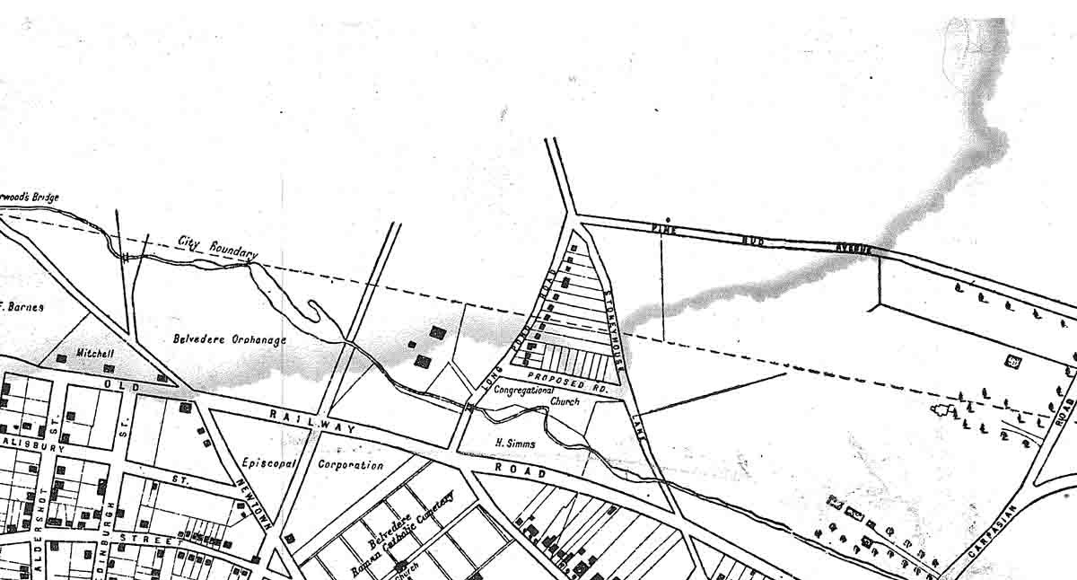
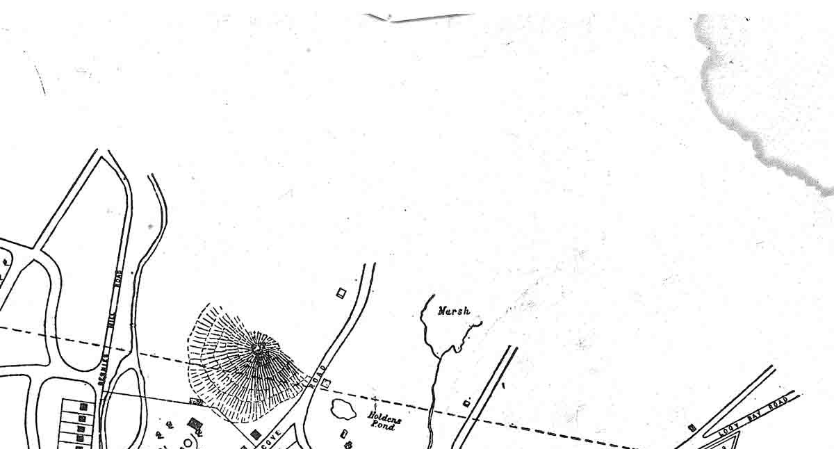
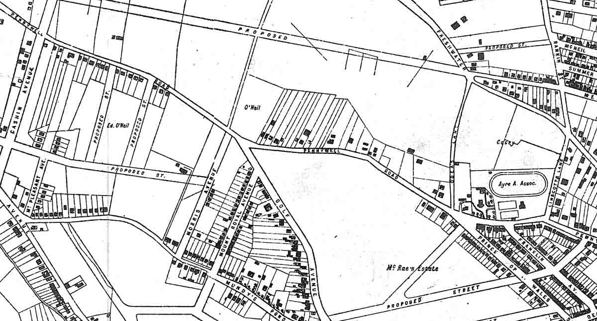
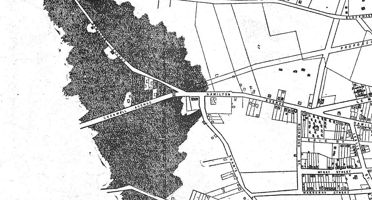
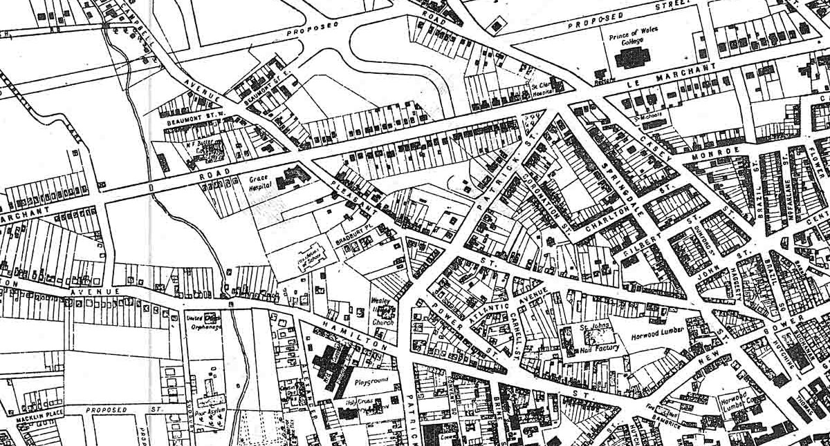
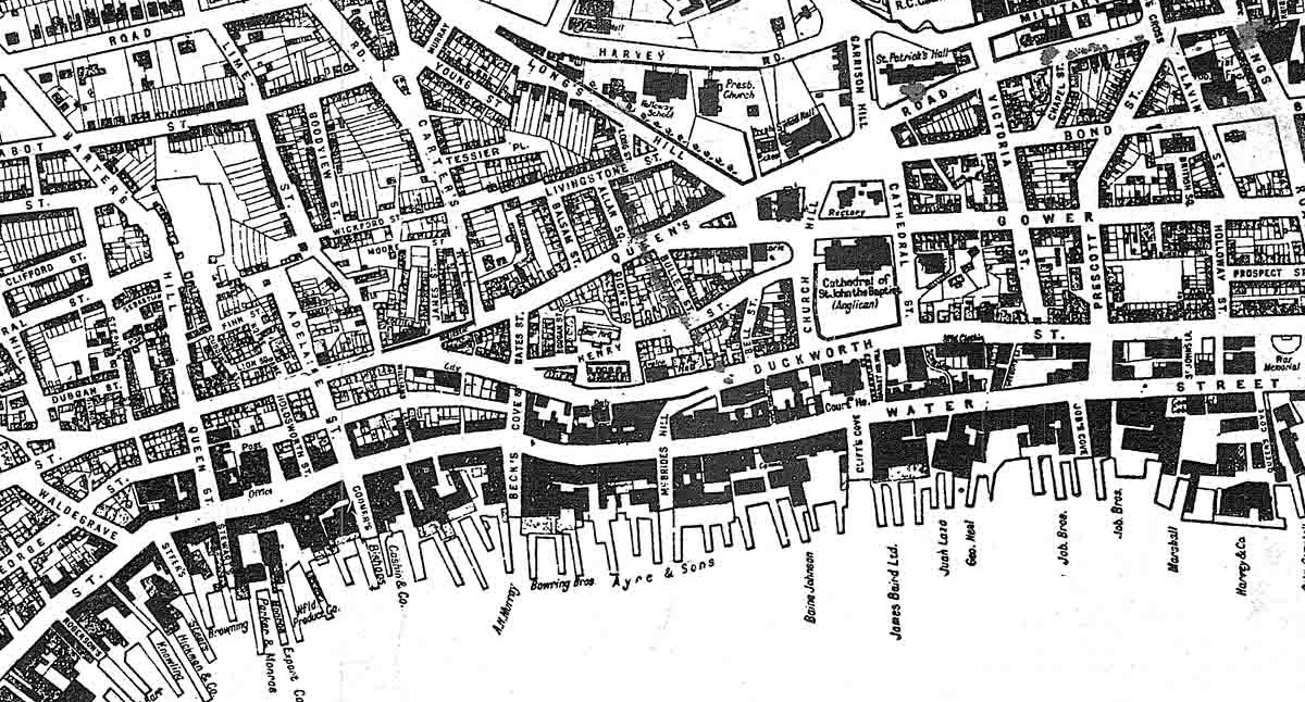
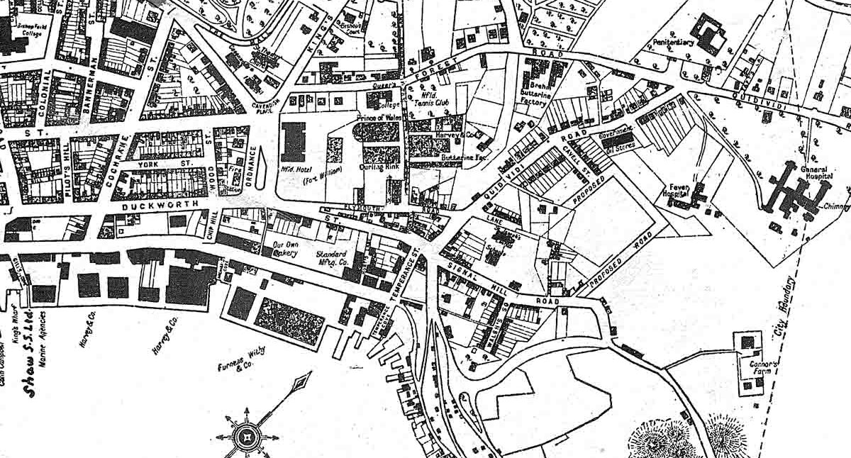
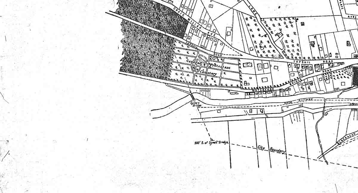
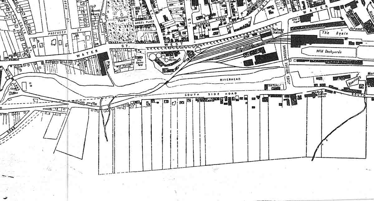
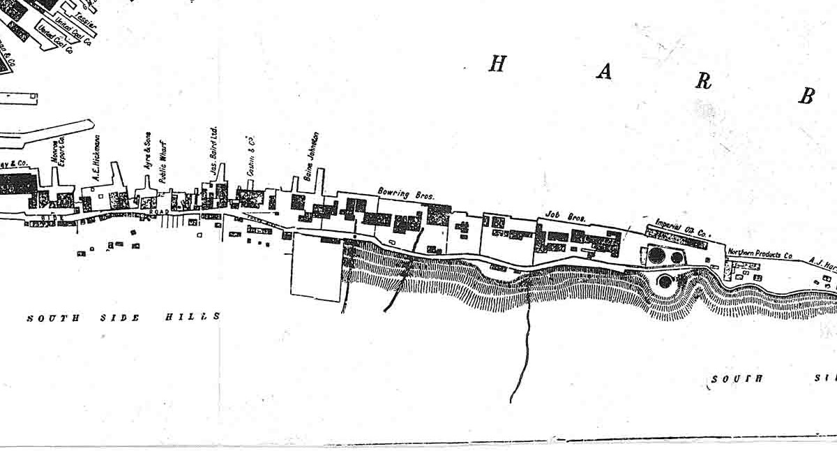
1932 Map of St. John's

This is a reproduction of an official large survey map done by the City of St. John's.
(Note: Full size copies are available from the St. John's City Archives)
This online version is divided into 16 segments for easier downloading.
Click on a segment to get a larger image of that portion.

Please note that these map files are large and
may be slow to load on a dial-up connection.

1932 St. John's Map Section 1 1932 St. John's Map Section 2 1932 St. John's Map Section 3 1932 St. John's Map Section 4
1932 St. John's Map Section 5 1932 St. John's Map Section 6 1932 St. John's Map Section 7 1932 St. John's Map Section 8
1932 St. John's Map Section 9 1932 St. John's Map Section 10 1932 St. John's Map Section 11 1932 St. John's Map Section 12
1932 St. John's Map Section 13 1932 St. John's Map Section 14 1932 St. John's Map Section 15 1932 St. John's Map Section 16

Map obtained from Harris's Barbershop and scanned by Wade Company Limited
Reproduced by Permission of St. John's City Archives
Contributed by Robert Royle (July 2004)

Page Revised by Craig Peterman (Tuesday March 26, 2013)

Newfoundland's Grand Banks is a non-profit endeavor.
No part of this project may be reproduced in any form
for any purpose other than personal use.

JavaScript DHTML Menu Powered by Milonic

© Newfoundland's Grand Banks (1999-2023)

Hosted by
Chebucto Community Net

Your Community, Online!

Search through the whole site
[Recent] [Contacts] [Home]