
To contribute to this site, see above menu item "About".
These transcriptions may contain human errors.
As always, confirm these, as you would any other source material.
District Photo Album
St. Georges District
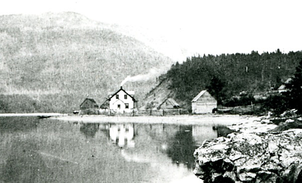 |
“The Beach” or “Brake’s Point” at Riverhead A recent evaluation and comparison of the location using cadastral mapping, railway maps Special thanks to Jim Warford, Leslie A. Winsor and Linda White Photo used with the permission of the Archives and Manuscripts Contributed by Linda Elkins-Schmitt |
Page Revised by Craig Peterman (Wednesday September 24, 2008)
Newfoundland's Grand Banks is a non-profit endeavor.
No part of this project may be reproduced in any form
for any purpose other than personal use.
JavaScript DHTML Menu Powered by Milonic
© Newfoundland's Grand Banks (1999-2025)
Hosted by
![]()
Your Community, Online!
![[Recent]](../recent.gif)
![[Contacts]](../contacts.gif)
![[Home]](../home.gif)