![]()
Presented by the
Newfoundland's Grand Banks Site
to assist you in researching your Family History
Click on the graphic below to return to the NGB Home Page
To contribute to this site, see above menu item "About".
How to report a possible transcription error
These transcriptions may contain human errors.
As always, confirm these, as you would any other source material.
Old Croque Cemetery
Croque
St. Barbe District
 |
|
|
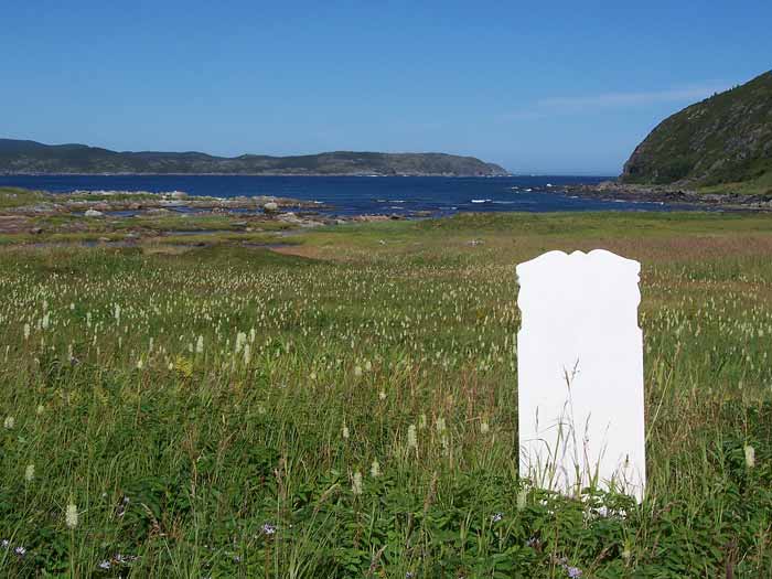
Old Croque Cemetery A summer field picture of Allen's grave site. You are looking almost
northeast towards the entrance of
Photographed and Copyrighted by Francis R. Reardon Sr. (February 2007) |
|
Page Revised by Craig Peterman (Friday March 22, 2013)
Newfoundland's Grand Banks is a non-profit endeavor.
No part of this project may be reproduced in any form
for any purpose other than personal use.
JavaScript DHTML Menu Powered by Milonic
© Newfoundland's Grand Banks (1999-2025)
Hosted by
![]()
Your Community, Online!
![[Recent]](../recent.gif)
![[Contacts]](../contacts.gif)
![[Home]](../home.gif)